Visit Ethiopia – Sador Ethiopia Tours

UNESCO World Heritage Site

UNESCO World Heritage Site

Tiya

Tiya – UNESCO World Heritage Site Home Tiya Tiya is among the most important of the roughly 160 archaeological sites discovered so far in the Soddo area, south of Addis Ababa. The pre historic site of Tiya in Southern Ethiopia houses 36 obelisks, including 32 carved stelae covered with symbols, believed to be ancient tomb stones. According to UNESCO, these are the remains of ancient Ethiopian cultures whose age has not yet been precisely determined. The erection of megalithic monuments such as those is a very ancient tradition in Ethiopia. These obelisks are not soaring monoliths as in Axum, but they contain depictions of swards and various symbols not found in other regions.   Ready to Travel With Real Adventure Check Availability

UNESCO World Heritage Site

Fasil Ghebbi – UNESCO World Heritage Site

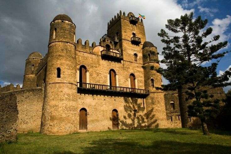
Fasil Ghebbi – UNESCO World Heritage Site Home Fasil Ghebbi Fasil Ghebbi is the name given to the unique 17th century fortress city located in the northern town of Gondar, literally meaning “Fasil’s premises”. Often described as the Camelot of Africa, Fasil Ghebbi served as the royal residence of Ethiopian emperor Fasilidas and his successors at a time when Gondar was the country’s capital. Enclosed within the 900-metre long wall are crenellated castles, palaces, churches and other buildings, some of them still intact enough to give an excellent impression of the era. Just outside the fortress city, lies the “bathing palace” of Fasilidas which these days is filled with water once a year to commemorate the Timket (epiphany) festival. Ready to Travel With Real Adventure Check Availability

UNESCO World Heritage Site

Melka Kunture

Melka Kunture – UNESCO World Heritage Site Home Melke Kunture The cluster of Pleistocene archaeological and palaeontological sites of Melka Kunture and Balchit lies along the upper course of the Awash River, on the Ethiopian Highlands, at an altitude of about 2,000 to 2,200 metres above the sea level. With a relatively continuous stratigraphic sequence formed by the accumulation of fluvial/alluvial and volcano-derived deposits interposed with tuff, the property preserves an exceptionally long cultural sequence consisting of four consecutive phases of the Oldowan, Acheulean, Middle Stone Age and Late Stone Age techno-complexes, documented in a variety of archaeological contexts, testifying to the occupation of the area by hominin groups from two million years ago. Fragments of palaeo-landscapes preserved buried under the volcanic and sedimentary deposits with fossil fauna and flora allow to reconstruct the high-mountain ecosystem of the Ethiopian Highlands during the Pleistocene and draw conclusions on the adaptation of hominins to the challenges and climatic conditions of high altitudes. The presence of Homo erectus, Homo heidelbergensis and archaic Homo sapiens fossils, found in association with well-dated archaeological material, throws light on the development of skills and cognitive capacities in the early hominin groups. Rich concentration of varied lithic assemblages made from volcanic rocks with different knapping techniques, and evidence of high-quality of standardised obsidian tools, suggest a level of planning and innovation. Evidence of the centuries-long tradition of procurement and use of obsidian starting with the Oldowan industry makes the property the earliest known example of obsidian utilisation and an outstanding witness of continuity of exploitation of this raw material. Ready to Travel With Real Adventure Check Availability

UNESCO World Heritage Site

Bale Mountains National Park

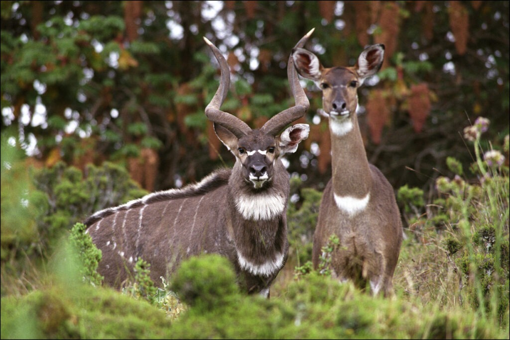
Bale Mountains National Park – UNESCO World Heritage Site Home Bale Mountains National Park Bale Mountains National Park (BMNP) boasts a spectacularly diverse landscape mosaic comprised of distinct ecosystems and habitats and associated biodiversity. The property covers an area of 215,000 hectares in the heart of the Bale-Arsi Massif in the south-eastern Ethiopian Highlands in Oromia National Regional State. Building upon much earlier efforts, the National Park has been legally protected and demarcated since 2014. The property includes Africa’s largest area of afro-alpine habitat above 3,000 m above sea level (asl) with numerous glacial lakes, wetlands, and moorlands. Volcanic ridges and peaks tower above the plateau, most prominently Tullu Dimtu, Ethiopia’s second highest peak at 4,377 masl. Elsewhere in the park, extensive grasslands thrive next to various types of forests including tree heath, bamboo, and juniper forests. Significantly, the southern slopes of the Bale Mountains descend dramatically into the famous Harenna Forest, the second largest moist tropical forest in Ethiopia, including patches of cloud forest. Ready to Travel With Real Adventure Check Availability

UNESCO World Heritage Site

Gedeo

Gedeo – UNESCO World Heritage Site Home Gedeo Cultural Landscape The property lies along the eastern edge of the Main Ethiopian Rift, on the steep escarpments of the Ethiopian highlands. An area of agroforestry, it utilizes multilayer cultivation with large trees sheltering indigenous enset, the main food crop, under which grow coffee and other shrubs. The area is densely populated by the Gedeo people whose traditional knowledge support local forest management. Within the cultivated mountain slopes are sacred forests traditionally used by local communities for rituals associated with the Gedeo religion, and along the mountain ridges are dense clusters of megalithic monuments, which came to be revered by the Gedeo and cared for by their elders. Ready to Travel With Real Adventure Check Availability

UNESCO World Heritage Site

Konso

Konso – UNESCO World Heritage Site Home Konso The Konso people live in an isolated region within the Omo River Valley. Since the Konso people live within a hardship area, their villages are fortified by a stone wall used as a defensive barrier. The Konso people live within groups of communities whereby each community has a main hut. A Konso community has to be through a main gate and into a maze of al-leyways. The alleyways are incorporated into the overall design of the communal village set up as a security measure that makes it difficult for enemy warriors to gain access into the village. The Konso people are mixed agriculturists. They are known to grow crops even though the lands in which they live in are dry and infertile. They use animal dung from their cattle to fertilize the grounds on which they mainly grow sorghum. They use the sorghum as a flour for their meals and to also brew local beer. They also grow grains such as beans and maize. According to Konso tradition, they have erect stone walls and poles around their communal villages in a traditional ceremony that is marked every 18 years. This is the ceremony that also marks the start of a new generation within their tribal community. By counting the number of generation poles in any Konso village, one is able to determine the age of the said village. The erection of stones and poles is part of the Konso tradition. The Konso mark their graves by placing carved wooden statues on top of the grave. They call these wooden markers Waka. Ready to Travel With Real Adventure Check Availability

UNESCO World Heritage Site

Harar

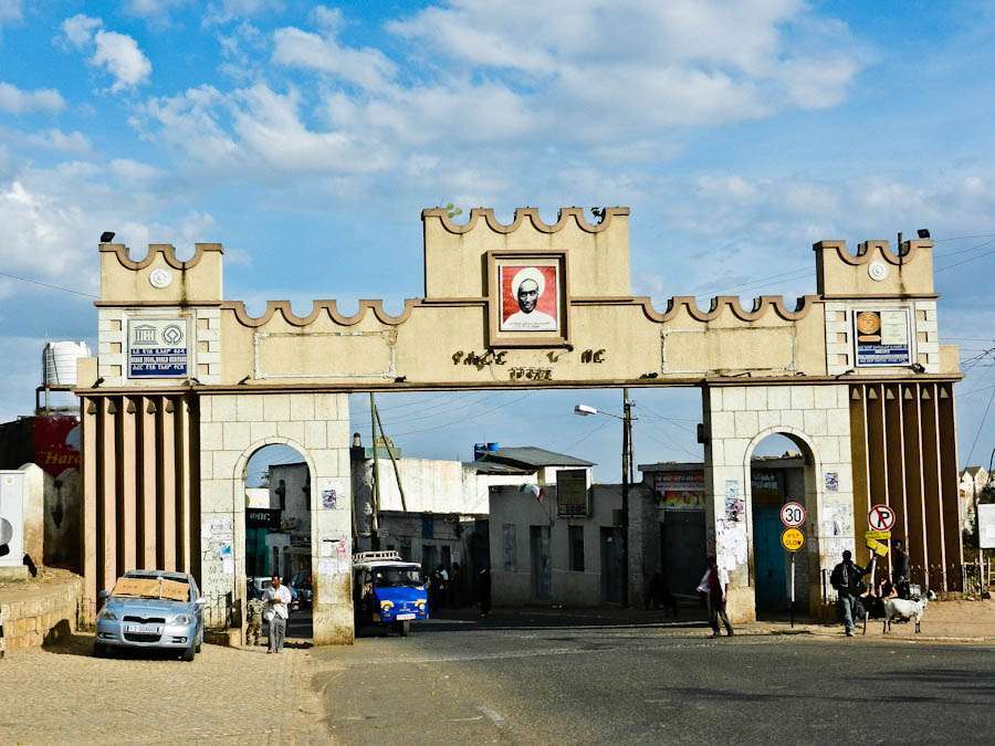
Harar – UNESCO World Heritage Site Home Harar Jugol The fortified historic town of Harar is located in the eastern part of the country on a plateau with deep gorges surrounded by deserts and savannah. The walls surrounding this sacred Muslim city were built between the 13th and 16th centuries. Harar Jugol, said to be the fourth holiest city of Islam, numbers 82 mosques, three of which date from the 10th century, and 102 shrines, but the townhouses with their exceptional interior design constitute the most spectacular part of Harar’s cultural heritage. The impact of African and Islamic traditions on the development of the town’s building types and urban layout make for its particular character and uniqueness. Ready to Travel With Real Adventure Check Availability

UNESCO World Heritage Site

Lower Omo Valley

Lower Omo Valley – UNESCO World Heritage Site Home Lower Omo Valley The Lower Omo Valley is one of the most ethnically diverse parts of Africa. It is a land of warriors, hunters and nomads whose distinct age-old lifestyles are being changed by the outside world. Still, they are people whose daily existence and ways of life are ruled by traditions. South Omo possesses various natural and historical resources and attractions such as tunnels, waterfalls, wide and large forests and historical sites. However, the day-to-day life of the South Omo ethnic groups is truly the heart and soul of the valley. Special ritual ceremonies include ukuli or cattle jumping by Hamar and Banna men as a rite of passage ceremony, keal which is the Bodi fatness competition and donga, the Mursi stick fight competition. The South Omo zone is home to more than 16 ethnic groups whose populations number between 1,000 and 300,000 people each. The natural customs and environments of all these inhabitants are varied. The South Omo ethnic groups include: Ari, Arbore, Bacha, Banna, Bodi, Brile (Ongota), Dassanech, Dime, Hamar, Kara, Kwegu, Maale, Murle, Mursi, Nyangatom, and Tsemay. Each group has their own language belonging to one of the three language families: Nilotic languages are spoken by Bodi, Kwegu, Murle, Mursi and Nyangatom. Omotic languages are spoken by Ari, Banna, Bashada, Dime, Hamar, Kara and Maale. Cushitic languages are spoken by Arbore, Brile, Dassanech and Tsemay. Ready to Travel With Real Adventure Check Availability

UNESCO World Heritage Site

Lower Awash

Lower Awash – UNESCO World Heritage Site Home Lower Awash One of the world’s most famous hominid fossils, known as ‘Lucy, was discovered in the Lower Awash Valley in the searing heat of the eastern Afar region. The area contains some of the most important paleontological remains on the African continent, and these discoveries – some of which are at least 4 million years old – have enabled scientists to gain invaluable insights into human evolution. The 3.5 million-year-old “Lucy” was reconstructed after 52 fragments of a skeleton were found in 1974 – about 40 percent intact. The study of this early hominid skeleton has provided clues as to when and how humans began to walk upright. Ready to Travel With Real Adventure Check Availability

UNESCO World Heritage Site

Fasil Ghebbi, Gondar Region

Fasil Ghebbi, Gondar Region – UNESCO World Heritage Site Home Fasil Ghebbi Fasil Ghebbi is the name given to the unique 17th century fortress city located in the northern town of Gondar, literally meaning “Fasil’s premises”. Often described as the Camelot of Africa, Fasil Ghebbi served as the royal residence of Ethiopian emperor Fasilidas and his successors at a time when Gondar was the country’s capital. Enclosed within the 900-metre long wall are crenellated castles, palaces, churches and other buildings, some of them still intact enough to give an excellent impression of the era. Just outside the fortress city, lies the “bathing palace” of Fasilidas which these days is filled with water once a year to commemorate the Timket (epiphany) festival. Ready to Travel With Real Adventure Check Availability

Scroll to Top